Sunday, March 4, 2012
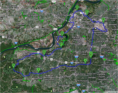
62 Mile Bike Route In and Around St. Louis Area (Training for 56 mile)
Click Here to link to Google Maps. Ride is quite long and there may be some delay for the map to open in Google Maps. There are several areas on the route that call for caution with traffic. Particularly when approaching the airport as well as crossing under Highway 70 on the Earth City Expressway, as well as areas near the Chesterfield Mall. The area around the Mills Mall, Missouri Bottom Road, and Babler Park is fantastic. The ride can be cut short in a number of ways, and this is easily manageable in Google Maps by moving the pins. Great distance for 56 mile training.
St. Louis Triathlon Website Launch
Good runs, bikes and swims are hard to find.This site is not for profit and is a simple information exchange for local athletes looking for routes for swimming, running, and biking.
Please feel welcome to post content and or send content in to be posted. If you value the site, please contribute your own route maps and other are specific information.
Good runs, bikes and swims are hard to find. Welcome to SaintLouisTriathlon.Com.
Please feel welcome to post content and or send content in to be posted. If you value the site, please contribute your own route maps and other are specific information.
Good runs, bikes and swims are hard to find. Welcome to SaintLouisTriathlon.Com.
Subscribe to:
Posts (Atom)

